Prestige Garden Breez Location
Prestige Garden Breez is located on Sarjapur - Marathahalli Road, Bengaluru, Karnataka 562125. The project is in a prime location in Yamare village near the major IT hubs of Whitefield. It is close to Bengaluru Technological Institute, offering seamless connectivity to major areas of the city, such as
- Varthur
- Bellandur
- Whitefield
- HSR Layout
- Electronic City

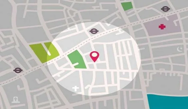
The exact location of Prestige Garden Breez is VQGG+RJ, Sarjapur - Marathahalli Road, Yamare Village, Sarjapur Road, Bangalore, Karnataka 562125. The address is in the Eastern part of Bangalore, adjacent to the upcoming Prestige Tech Park. Prestige Garden Breez location map google map can be tracked with Latitude: 12.87836° N, and Longitude: 77.77619° E.

Prestige Garden Breez has an excellent connectivity through a network of roads, including Outer Ring Road, NH 44, NH 948A, and SH 35. The SH 35 runs close to the project location, and it will make daily travel easy for the residents. The area offers excellent connectivity with easy access to the Bangalore airport, the metro stations of the Purple Line, and the railway lines.
Major Roads connecting from Sarjapur:
- NH 44
- Sarjapur Main Road
- SH 35
- NH 948A
- Outer Ring Road
- Hosur Road
- Varthur Road

Residents of Prestige Garden Breez can easily reach the Kempegowda Airport by taking the NH-648 route. The airport is 1 hour and 10 minutes away from the airport which helps residents to travel worldwide easily.
- Kempegowda Airport – 64.3 km

Prestige Garden Breez residents can easily access the Purple Line of the metro to travel to all areas of the city without any traffic issues in less time. The upcoming Red Line of the metro is nearby, and it will further improve the transport network of the area.
- Hopefarm metro station - 14.2 km

The project's proximity to the prime railway stations of Bangalore makes access simple for the residents. Heelalige Railway Station is the nearest station, which is just 35 minutes from the project when reached through through Sarjapur - Marathahalli Road.
- Heelalige Railway Station – 16.9 km

Prestige Garden Breez, constructed in the Sarjapur region, offers easy access to major state and national highways, which connect all the areas of the city easily. The project site is near a major bus stop, which can be reached in 12 minutes.
- Sarjapur Bus Stand – 4.2 km

Kaikondrahalli Lake is a beautiful, ecologically rich lake that covers an area of 48 acres. It has a big walking trail of 1.6 km in size, which is best for a morning walk. The area features 70 different species of birds, and it is heaven for bird lovers. There is a small island inside with wooded areas around it, which adds to its appeal.

Muthanallur Lake is a man-made lake that is planned over 600 acres and it has over 510 species of flora and fauna. Some of the wildlife here includes grey mongoose, Asian palm civet, smooth-coated otter, and Indian jungle cat. It is the best place to take a morning walk and to relax with a lot of green areas around.

Lalbagh Botanical Garden is a historic garden that is over 240 acres, and it was first started by Hyder Ali in the 18th century. It was later developed by the British. Now, it has more than 1,000 difference plant species. It has century-old trees, and it also features India’s famous Glass House, which is designed after London’s Crystal Palace.

Play Arena is one of the big adventure hubs, and it has 30+ activities to explore. The arena spreads over a 4-acre campus, and the timings are from 10 AM till 11 PM. There are popular outdoor game options such as laser tag, archery, wall climbing, skating, go-karting, paintball, basketball, and cricket nets.

Cubbon Park is a 300 acres park that was started in 1870. It has 6,000+ trees and is known as the green lung of the city. The park is ideal for morning walks, photography, cycling, jogging, picnics, and weekend outings. The park features Bal Bhavan, and it also has a toy train for kids.

Sarjapur Road is a prime residential hotspot in the eastern part of Bangalore with high-end social infrastructure. Sarjapur Road, Bangalore, pin code is 562125, which is conveniently located near major areas such as Marathahalli, Bellandur, and Whitefield. The area offers access to significant IT hubs of East Bangalore that are heavily developed. Sarjapur Real Estate is growing at a fast rate as the price is affordable, and it also has potential for good ROI.

Sarjapur Road enjoys good connectivity that is further enhanced by major routes such as Hosur Road, ORR, and NH 44. The proposed Metro Phase 3A will connect Sarjapur to Hebbal. This planned metro line will reduce commute time to North and Central Bangalore. Improved access is a key factor for residents planning to invest in Sarjapur Road real estate.

Sarjapur has good road access to all major areas through connected roads. BMTC buses are available at regular intervals, and they help to travel to all major areas of the city. The area is well connected through prime roads that include
- Outer Ring Road - Connects Sarjapur Road to Bellandur, HSR Layout, Silk Board, and with major IT parks.
- Hosa Road - Links the area to Electronic City
- Haralur Road - Connects to HSR Layout
- Sompura Road - Connects Sarjapur town and Attibele.
- Chikka Tirupathi Road - Connects Sarjapur Road to the rural outskirts.

There is no direct metro network to Sarjapur Road currently, but the upcoming Phase 3A metro line will give a direct metro network. Now, it has access to all the metro stations of the Purple Line.

Kempegowda Airport is conveniently accessible from Sarjapur Road anytime. There are buses and cab services that are available to reach the Bangalore airport in a short time.
- Prestige Tech Park - 15.4 km
- Cessna Business Park - 15.5 km
- Pritech Park SEZ – 15.2 km
- RMZ Ecoworld – 14.8 km
- ITPL - 17.8 km
- RGA Tech Park – 10.9 km
- Vaishnavi Tech Park – 15.6 km
- Manipal Hospital - 13.5 km
- Narayana Clinic - 15.2 km
- Town Hospital Sarjapura – 5.2 km
- Motherhood Hospital – 14.9 km
- Sakra World Hospital - 16.2 km
- Spandana Hospital – 4.7 km
- Delhi Public School - 8.3 km
- The Green School – 10.8 km
- Sri Ram Public School – 4.2 km
- Deens Academy - 9.1 km
- New Oxford School – 6.9 km
- Harvest School - 9.2 km
- Phoenix Market City – 21.1 km
- Nexus Whitefield – 13.9 km
- Virginia Mall – 13.4 km
- Central Mall – 22.8 km
- Brookfield Mall – 15.2 km
- Park Square Mall – 18.1 km
- Bellandur – 16.5 km
- HSR Layout – 17.9 km
- Whitefield – 14.7 km
FAQS
The project is located in Yamare Village, Sarjapur Road, in East Bangalore.
It is 28.9 km from the project.
The nearest station is Heelalige Railway Station, which takes 35 minutes to reach.
The nearest metro line is the Purple Line, where the Hopefarm metro station is at a distance of 14.2 km.
The nearest airport is the Kempegowda Airport, which is 64.3 km from this project and can be reached easily through NH 648.
Related Location Pages

